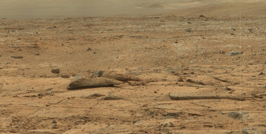
This striking pair of rocks reminded me of “beached whales” on first glance, but I think they do look more like fish. ( And doesn’t that look like a dinosaur bone to the right, there? ) They are prominent in a beautiful 37 Meg panorama formed from a 6×6 array of 36 mastcam images from Sol 109. Too big to upload. This 3 Meg “detail” is really what I was interested in, anyway. I included enough to show some foreground and “Ellis Island” in the background ( which defines the direction of the view. )
How big are they? they seem to be in the 6-10 foot range, to me. Dunno. They are visible in a few of the Navcam views, but I’ll leave that as an exercise for now.
Curiosity must have been interested to devote all this bandwidth to it. It’s kind of an “off” view, looking far to the right of “Yellowknife Bay”, where Curiosity was headed at this point. These rocks are typical of a number of formations in the area, even including the cross sectional cleavage. I think the “scaly” texture is the layering so predominant at Gale, and the cleavage occurs when these sculpted outcroppings get undercut and can no longer support their own weight. Imagine sitting there watching one of these develop for thousands upon thousands upon thousands of years! ( That covers a million, right ? )
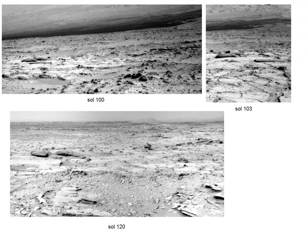
Update: Here are three views of the “dead fish” formation taken from Navcam panoramas for the labeled sol dates. The sol 100 images were taken at a shorter focal length, accounting for the smaller appearance. It was actually about the same distance from Curiosity as on sol 103. ( I can tell right away because PTgui makes crazy looking spiky squares for these short focal length images. )
The view directions are roughly SE, SSE, and NE, in that succession. On sol 120, Curiosity was at “shaler”, which is visible in the foreground ( and also on the right side of the sol 100 view.) You can see that the dead fish are just to the NE of shaler. I’m frustrated and puzzled that Curiosity didn’t get more Mastcam shots of them, especially since it went right by them on the way over to Yellowknife Bay, visible in the sol 120 view behind the dead fish.
Using the sol 103 view, I was able to calibrate the angular scale of the photo and determine that the frontmost “fish” subtended about 0.068 radians. Using the JPL track map, I estimated the distance at 30 meters, giving 2.0 meters as its length.


These are really interesting “artifacts.” so you are surmising that the ” dead fish” are 6 to 10 feet long?
Of course, “artifact” isn’t really the word … presumably! Well, I guess there is a more general sense of the word. Maybe they are more like 4 or 5 feet. It is hard to judge. I’m just using the appearance of the ground near them for a subjective distance scale. Since they do appear in a number of images, maybe I can triangulate them and get a quantitative estimate. “Oh no! Homework!”