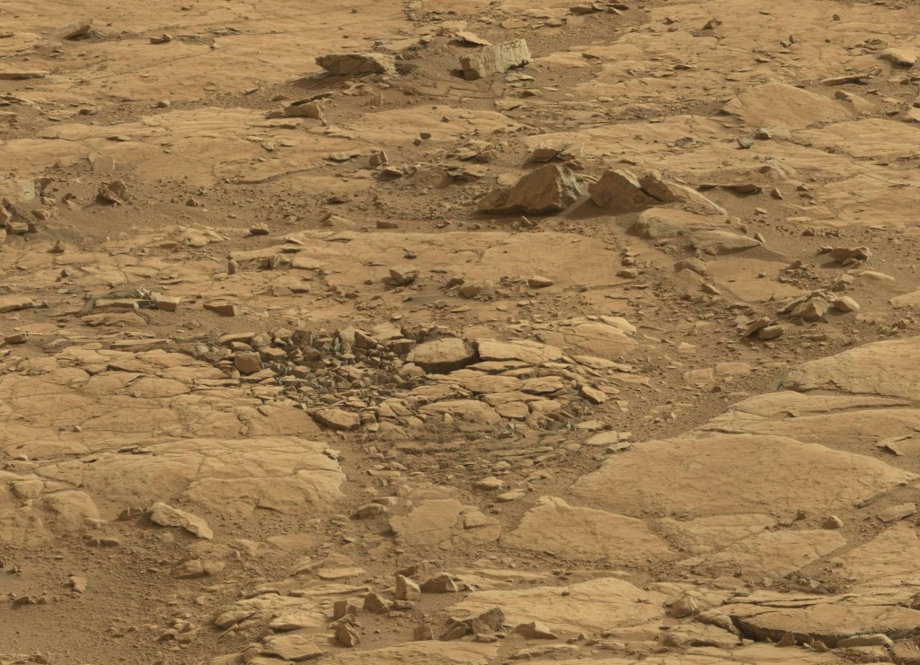
Here’s an excerpt from a very large panorama made from 135 sol 184 Mastcam images. It’s missing 5 images as “holes” in its proper 7X20 array, and sometimes these show up later in the image gallery, so I’ll hold off on posting that, and just show this excerpt: ( click to enlarge )

The panorama is a rather uninteresting vista, except for its sheer scope, of the western end of Yellowknife Bay from the vantage of the Drill Site. But the detail does show off this interesting structure that I’m calling the Mare’s Nest, which seems to be similar to the “seashells” of my previous post. Surely it’s a real question how these structures formed, and from the name I’ll give myself license to speculate a little bit.
It suggests to me that the ground was shattered by an impact, possibly a secondary impact of a boulder flung from some meteorite fall. I suppose that these must have been quite common over the aeons. On the moon, the well tilled surface is the result of this kind of “gardening” as it is called, and the entire surface is a rubble heap. On Mars, we might suppose that while more orderly processes have given the surface a stratified structure, impacts have still left their mark, and remain in place for millions of years. … So there you are, a mare’s nest!
